Ashland Forest Resiliency Project News (View All)
Controlled Burning Above Town - Lingering Smoke
UPDATE 10:30 a.m., Monday, December 4: The Ashland Forest Resiliency Partnership completed a challenging 110-acre controlled burn above Reeder Reservoir this weekend and smoke is still lingering in parts of town this morning. The expected weather systems will help disperse smoke today and tomorrow. If conditions are good, a small, 15-acre high elevation burn is planned this week around Panther Peak. We do not expect further smoke in town from that burn should it go ahead.
UPDATE 9 a.m.,Saturday, December 2: Crews from Lomakatsi Restoration Project burned 50 acres yesterday with minimal smoke impacts in town. Today, they will target 55 acres to close out this 110 acre burn unit. Thanks to all the workers for spending a wet Saturday making us safer and our forests healthier! Expect to see smoke again and stay aware for possible evening smoke in town.
UPDATE 11:30 a.m., Friday, December 1: Crews are making good progress and expect to burn 50 acres today as allotted through the State's smoke management system. Smoke is moving to the east away from town. Depending on conditions this evening, smoke could move downslope into town. Please be aware and take precautions as necessary if you smell smoke.
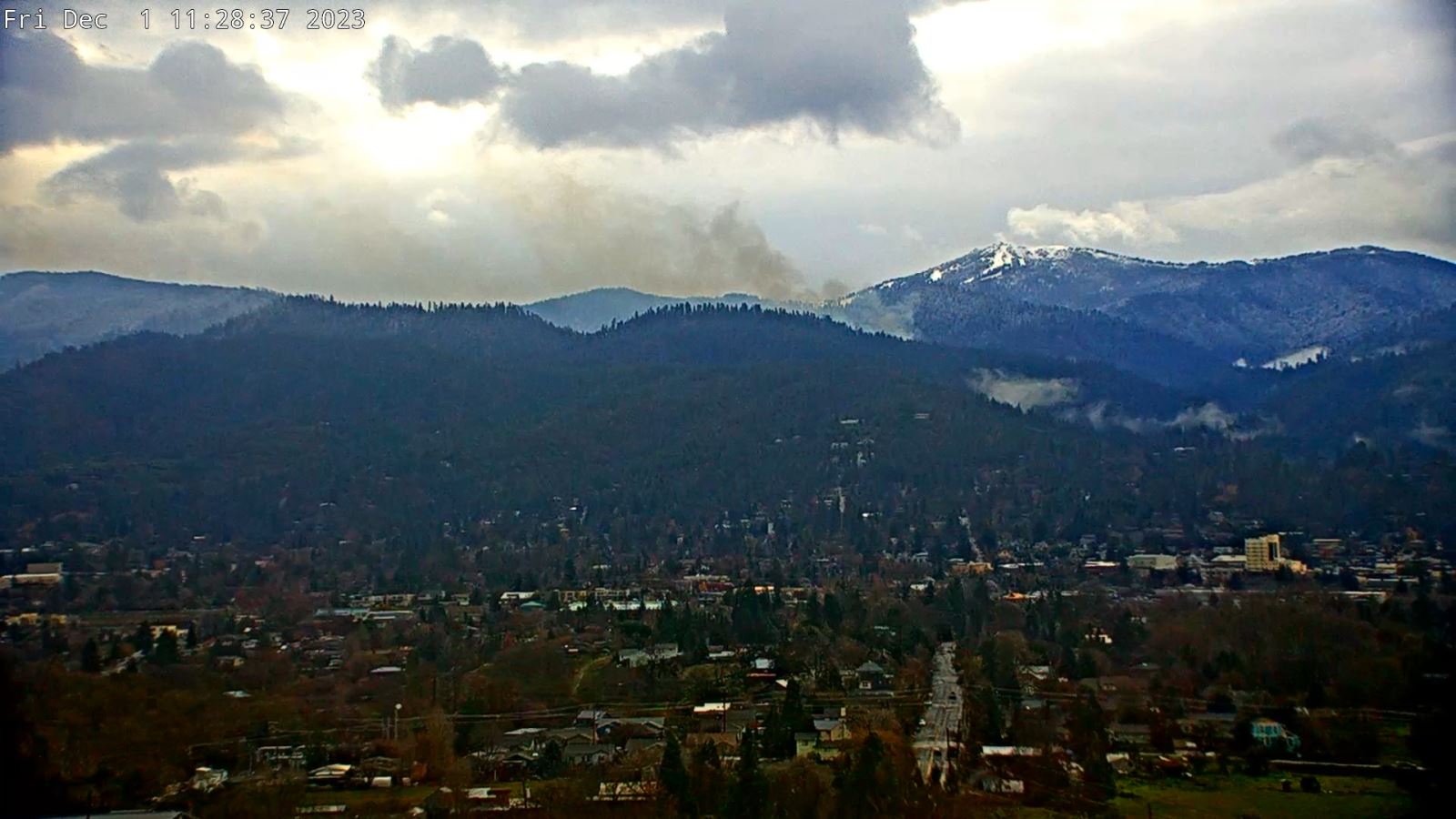
Beginning Thursday November 30, the Rogue River-Siskiyou National Forest is managing a controlled burn on behalf of the Ashland Forest Resiliency Project. The controlled burn is located along Winburn Ridge above Reeder Reservoir. Burning will continue over the next few days and into the weekend as crews work to reduce wildfire risk.
Smoke to Impact Town in the Evening Hours
Smoke is expected to impact town in the evening hours including Lithia Park, the downtown area, streets along Ashland Creek (Oak, Helman) and around the dog park. During the day, smoke could move south and may impact trails and roads in the upper watershed. Expected rain and weather systems will help disperse smoke, making this a favorable time for reducing wildfire hazard to town and our watershed.
If you need assistance signing up for controlled burn notifications, please email afrpartners@ashland.or.us or leave a message at 541.552.2218.
What To Do When There’s Smoke In the Air
Please close windows in the evening, and those sensitive to smoke should stay inside and use a HEPA quality air purifier if air quality declines. Our Smokewise Ashland site has all the resources you need to stay healthy when smoke is in the air.
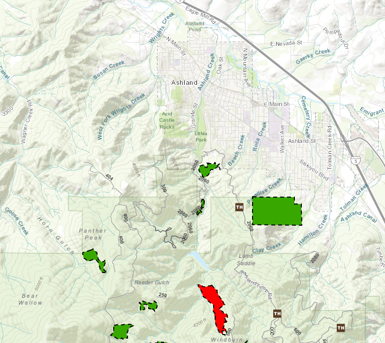
Check weather and smoke on the watershed camera and see the burn location on the controlled burn map. See alternative recreation routes here.
Map of Controlled Burn Location
Click here for a video about proactive fire planning to learn how controlled burning is helping make our forests healthier and our community safer in the face of increasingly hot and dry summers.
To receive non-emergency burning and smoke alerts:
- Text WATERSHED in the message line to 888777 for non-emergency notifications
- Register for the AFR email
- Follow AFR on Facebook
- Learn more on our website
Online City Services
Pay your bill & more
Ashland Fiber Network
Evaluation
& Notifications
Inspection
Applications
Permits & Licenses
Recreation Programs